Apartments Near North Station Boston: Commuting, Schools and Daily Logistics
Apartments near North Station, Boston, measured rather than claimed: Haymarket four minutes on foot, North Station six, every Commuter Rail branch out of the terminal, the South Station split, Logan and parking. Plus why a listing site's assigned-school field is unreliable in Boston.
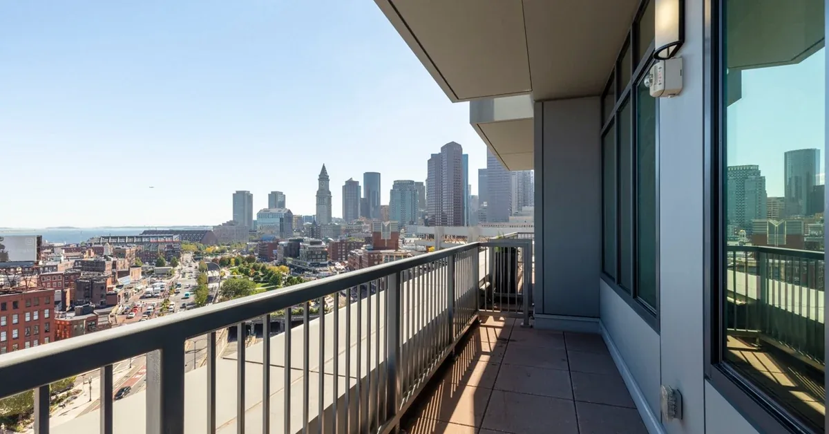
What living near North Station actually gives you
Apartments near North Station in Boston sit inside a four to six minute walk of two rapid transit stations and the entire northern half of the region's rail network. From 1 Canal Street, routed door to door on the OpenStreetMap foot profile on 5 October 2026, Haymarket is 0.19 miles and about four minutes on foot, and North Station is 0.29 miles and about six minutes on foot. Both stations carry the Orange Line and the Green Line. North Station is also the terminal for four Commuter Rail lines and for Amtrak's Downeaster to Maine.
That is worth stating as numbers rather than adjectives, because "steps from the T" appears on listings that are a fifteen-minute walk from a platform. Four minutes means you leave when the departure board says eight minutes rather than twenty, and in a February storm the distance between your door and a heated platform is about three hundred metres.
Haymarket and North Station: which lines, and how far
Haymarket is the closer of the two at 0.19 miles and about four minutes on foot, routed 5 October 2026. It is served by the Orange Line and the Green Line and is a substantial surface bus node on top of that, so for most downtown destinations it is the station you actually use. North Station, 0.29 miles and about six minutes on foot the same day, carries the Orange and Green Lines as well, so for subway purposes the two are partly redundant. What makes North Station matter is everything above the subway level, which the next section covers.
Downtown destinations are short. Government Center is 0.41 miles and about nine minutes on foot and State Street 0.45 miles and about ten, both routed 5 October 2026, so for much of the financial district the walk and the train take about the same time and the walk is more reliable.
On fares, the MBTA publishes a subway one-way fare of $2.40, a local bus fare of $1.70 and a monthly LinkPass at $90.00, accessed at mbta.com/fares on 5 October 2026. Since 1 September 2026 transfers between subway, bus and ferry are unlimited within a two-hour window on the same payment method, charged at the highest-priced service used. For a household running two LinkPasses the monthly transport line is a known and fairly small number, which is the comparison that matters when you weigh this rent against a cheaper address with a car attached.
The Commuter Rail out of North Station, and where it goes
North Station is the MBTA's north-side Commuter Rail terminal. Four lines run out of it: the Fitchburg Line west through Waltham, Concord and Acton; the Lowell Line north through Medford, Winchester and Woburn; the Haverhill Line through Reading, Andover and Lawrence; and the Newburyport/Rockport Line up the North Shore through Lynn, Salem and Beverly to Gloucester and Newburyport. Amtrak's Downeaster also runs from here into Maine.
This is the part people underweight when they tour. If your work, family or weekends are on the North Shore, in the Merrimack Valley or along the Fitchburg corridor, you are a six-minute walk from a seat rather than a drive to a park-and-ride followed by a train. The reverse commute is just as real: living here and working in Salem or Waltham means travelling against the morning flow from the terminal end of the line.
Commuter Rail fares run from $2.40 to $13.25 one way by zone, with monthly passes from $90.00 to $426.00, from mbta.com/fares accessed 5 October 2026.
One honest caveat: Commuter Rail is a scheduled service, not a turn-up-and-go network. Being six minutes from the terminal removes the uncertainty at your end but not the frequency at the other, and off-peak and weekend service is thinner than peak. Check the timetable for your specific station before treating the train as your default.
South Station is the other half of the network, and it is not here
Boston's Commuter Rail does not run through the city. North-side lines terminate at North Station; south-side and westbound lines terminate at South Station; there is no rail link between the two terminals. This is the single most important structural fact about commuting from this address, and it is the one that a listing's walk score will never tell you.
From 1 Canal Street, South Station is 1.13 miles and about twenty-four minutes on foot, routed 5 October 2026, or 1.82 miles and roughly five minutes by car in free-flow conditions on the car profile the same day. Most people make the trip on the Orange Line to Downtown Crossing and walk. It is a short hop, but it is a connection rather than a walk.
So be clear-eyed about who this address is wrong for. If you commute daily to Providence, Framingham, Worcester, Quincy or anywhere south, your terminal is South Station and you are adding a subway leg to every journey in both directions — perhaps fifteen to twenty minutes each way that someone living beside South Station does not spend. If that is you, the West End is not your best-connected option however good the walk to Haymarket is.
If you work downtown, in Cambridge via the Green Line to Lechmere, or anywhere north, this address is close to optimal. South Station still matters for Amtrak's Northeast Corridor and Acela to New York and Washington, but for occasional use a five-minute cab is a non-issue.
Getting to Logan Airport from the West End
Logan is 3.01 miles and about seven minutes by car in free-flow conditions from 1 Canal Street, routed on the car profile on 5 October 2026 — an unusual number for a residential address. Treat it as free-flow: the harbour tunnels queue at peak, and seven minutes becomes twenty or more when they do.
Without a car there are two sensible routes. The Blue Line to Airport station with the free Massport terminal shuttle is the standard one, reached via Government Center or State Street, both under a ten-minute walk as routed above. The Silver Line SL1 from South Station runs directly to the terminals and is free inbound from the airport, which makes it the better choice coming home with luggage.
The hospital and campus walk
Massachusetts General Hospital is about seven tenths of a mile from 1 Canal Street on foot. Our routing on the OpenStreetMap foot profile on 5 October 2026 returns 0.74 miles and 15.8 minutes to the Fruit Street address; the community's own published location guide gives 0.66 miles and 12.8 minutes. The distance is double-sourced at roughly seven tenths of a mile, and the durations differ only because the two assume different walking speeds, so the honest statement is thirteen to sixteen minutes on foot.
Suffolk University is 0.58 miles and about twelve minutes on foot, routed 5 October 2026 to the Tremont Street campus. For students and for hospital staff on a call schedule the useful quality of a walk is not its speed but its reliability — a thirteen-minute walk has no variance and a bike in a Boston February does. If you are weighing this address as a medical resident or graduate student, we have run that arithmetic in our guide for students and medical residents at One Canal.
Not everything is walkable. Longwood, Harvard, MIT and the Seaport are transit journeys rather than walks. Cambridge via the Green Line to Lechmere is quick; Longwood is the awkward one, taking the better part of forty minutes door to door however you do it.
One distance worth correcting while we are here: the nearest full supermarket is Whole Foods at 181 Cambridge Street, half a mile and about eleven minutes on foot, routed 5 October 2026 and confirmed as the closest of the Boston locations. You may see a three-minute figure quoted for groceries in this neighbourhood. That three minutes describes Haymarket's open-air produce stalls, which are excellent and cheap on a Friday but are not a supermarket and will not sell you a week's shop. Plan on the eleven-minute walk, or a delivery.
Driving from here, and what keeping a car actually means
If you do drive, the access is good. I-93 runs beneath this part of the city through the Thomas P. O'Neill Jr. Tunnel with downtown ramps close by, putting you on the interstate north or south quickly. The North Washington Street bridge takes you into Charlestown, and from Charlestown the Tobin Bridge carries US-1 north toward the North Shore. Storrow Drive is a short run west along the river. Getting around inside the city is the opposite story: the Bulfinch Triangle street pattern is tight and one-way in places, event traffic around the arena is real, and the tunnels queue. A car here is good for leaving and bad for staying.
On-site parking is available at One Canal, confirmed on the property feed and the community's published material as of 5 October 2026. We are not quoting a monthly rate: none is published on any source we read today, and a guessed number would be worse than no number. Ask the leasing office in writing for the rate on the space type you need, before you sign.
The arithmetic that decides this is simple. A car downtown costs a payment, Boston-rate insurance, a monthly space and running costs, and it sits unused most weekdays because the T is four minutes away. Two monthly LinkPasses at $90.00 each, per mbta.com/fares accessed 5 October 2026, is a far smaller number. Households moving here from a transit-poor city often find that dropping one car closes most of the gap between this rent and a cheaper suburban one. That is not a promise about your finances; it is the calculation residents here end up running, and it is why the walk times above are a financial fact rather than a lifestyle one.
How Boston school assignment actually works
Boston Public Schools does not assign children to schools by catchment. It runs a home-based assignment plan, in which your exact home address generates a personalised list of schools you may apply to: every school within a one-mile radius of your home, plus additional higher-rated schools pulled in as needed under the district's School Quality Framework, plus programmatic options, plus citywide schools that any family may choose. Most families end up with somewhere between ten and fourteen options. You then rank your choices, and at the close of each registration period an assignment algorithm matches students to seats based on any priorities that apply, a random number, and how many seats exist in that grade at each school in the order you ranked them. A top choice is not guaranteed.
This is why a listing site's "assigned school" field is structurally unreliable in Boston specifically. That field is populated from catchment polygons, and for this purpose Boston does not have them. What you are shown is either a guess or an import from a district that genuinely does assign by boundary. Two addresses on the same block can generate different lists, and the same address can produce a different outcome in a different lottery round or grade. Treating that field as an answer is the most expensive mistake a family relocating to Boston makes.
We will not publish a school name, rating or test score for this address, because any of those would be a guess dressed as a fact. Your options depend on your exact address, your child's grade and the round you apply in, and the only source that can tell you is the district. Read the policy and check your address at the Boston Public Schools student assignment policy page, then contact a BPS Welcome Center to register. Do that before you sign a lease, not after.
What to verify before you sign a lease near North Station
Ask which station a building actually means when it says it is near the T, and walk it yourself at the hour you would commute. A routed four or six minute walk is a different product from a claimed one, and the difference shows up every morning. Then confirm your terminal: if your rail line runs out of South Station, price the extra subway leg into your journey in both directions before deciding this address works.
Get the parking rate in writing before you commit, because no public rate is published, then ask for the full recurring-charge breakdown. At One Canal, utilities are billed by usage rather than bundled into rent, and the package locker service carries a charge of $75 per year billed separately, checked 10 September 2026. That locker charge is fixed and can be quoted exactly; rents cannot, because they are repriced daily.
One Canal's eleven floor plans run from a 411 square foot studio through six one-bedroom layouts between 649 and 996 square feet, four two-bedroom layouts between 976 and 1,309 square feet, and a 1,308 square foot three-bedroom, verified against the property feed on 5 October 2026. Pricing sits in the upper band for downtown Boston and moves daily, so treat any figure you see anywhere as indicative and confirm the current number with the leasing office. Current floor plans, amenities and availability are at One Canal.
Finally, understand the trade-off that comes with this block. You are two blocks from a major arena and event nights change the street. We have written that up with both sides in our piece on what living near TD Garden is really like. Read it before you decide — it is the part of this address people either do not mind at all or mind a great deal.
Walking and driving distances in this article were routed door to door from One Canal's published street address at 1 Canal Street, Boston MA 02114 on 5 October 2026, using the OpenStreetMap foot profile for walks and the car profile for drives, and are labelled by mode throughout. Where our routing and the community's own published location guide disagree on duration, both figures are given. Floor plan names, counts and square footage were verified against One Canal's property feed on 5 October 2026. The package locker charge was checked on 10 September 2026. MBTA fares and transfer rules are from mbta.com/fares, accessed 5 October 2026. Boston Public Schools assignment information is from the district's published student assignment policy and enrolment pages, accessed 5 October 2026, and no school assignment, rating or test score is predicted here. Drive times are free-flow and do not reflect peak congestion. AIR reprices apartments daily, so no exact rent is published above; confirm current pricing, availability and parking rates directly with the One Canal leasing office before making a decision.
Frequently asked questions
How far is One Canal from North Station?
North Station is 0.29 miles from 1 Canal Street, about six minutes on foot, routed door to door on the OpenStreetMap foot profile on 5 October 2026. Haymarket is closer still at 0.19 miles and about four minutes on foot.
Which subway lines serve North Station and Haymarket?
Both stations are served by the Orange Line and the Green Line. Haymarket is additionally a significant surface bus node. North Station is also the MBTA's north-side Commuter Rail terminal and an Amtrak Downeaster stop.
Which Commuter Rail lines run out of North Station?
Four: the Fitchburg Line west through Waltham, Concord and Acton; the Lowell Line north through Medford, Winchester and Woburn; the Haverhill Line through Reading, Andover and Lawrence; and the Newburyport/Rockport Line up the North Shore through Lynn, Salem, Beverly and out to Gloucester and Newburyport.
Can I get to South Station easily from the West End?
Yes, but it is a connection rather than a walk. South Station is 1.13 miles and about twenty-four minutes on foot from 1 Canal Street, or 1.82 miles and roughly five minutes by car in free-flow conditions, both routed on 5 October 2026. Most people use the Orange Line or the Green Line and Blue Line instead. If you commute daily on a south-side Commuter Rail line, build that extra leg into your journey time before choosing this address.
How do I get to Logan Airport without a car?
Take the Blue Line to Airport station and the free Massport terminal shuttle, reaching the Blue Line from here via Government Center or State Street, both under a ten-minute walk. Alternatively the Silver Line SL1 runs from South Station directly to the terminals and is free inbound from the airport. By car Logan is 3.01 miles and about seven minutes in free-flow conditions, routed 5 October 2026, though the harbour tunnels queue at peak.
How long is the walk to Massachusetts General Hospital?
About seven tenths of a mile, which works out at thirteen to sixteen minutes on foot. Our routing on the OpenStreetMap foot profile on 5 October 2026 gives 0.74 miles and 15.8 minutes to the Fruit Street address, while the community's own published location guide gives 0.66 miles and 12.8 minutes. The distance is consistent across both sources; the duration difference is a walking-speed assumption.
What does the MBTA cost each month?
The MBTA publishes a monthly LinkPass for subway and bus at $90.00, with one-way fares of $2.40 on the subway and $1.70 on local buses, accessed at mbta.com/fares on 5 October 2026. Commuter Rail is zone-based, from $2.40 to $13.25 one way and $90.00 to $426.00 monthly. Since 1 September 2026 transfers between subway, bus and ferry are unlimited within a two-hour window on the same payment method.
Is parking available, and what does it cost?
On-site parking is available at One Canal, confirmed against the property feed and the community's published material as of 5 October 2026. No current monthly rate is published on any source we checked, so we are not quoting one. Ask the leasing office for the rate on the specific space type you need, in writing, before you sign.
Which school would my child attend if I rent here?
There is no single answer, and anyone who gives you one is guessing. Boston Public Schools runs a home-based assignment plan rather than a catchment system: your exact address generates a personalised list of eligible schools, typically ten to fourteen of them, drawn from everything within a one-mile radius plus higher-rated and citywide options. You rank your choices and an assignment algorithm allocates seats using priorities, a random number and availability. Check your own address against the official BPS tools and speak to a Welcome Center before you sign.
Why is the "assigned school" field on listing sites wrong for Boston?
Because those fields are generated from catchment boundaries, and Boston does not assign by catchment for this purpose. The value shown is therefore either an estimate or an import from a district that does work that way. Two addresses on the same block can produce different school lists, and the same address can produce a different result in a different lottery round or grade. Use the district's own tools instead.